


NORTH LINN Voting District, Christian County, Missouri
About
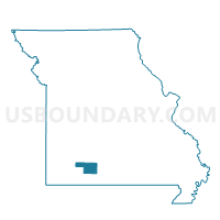
Outline

Summary
| Unique Area Identifier | 607486 |
| Name | NORTH LINN Voting District |
| County | Christian County |
| State | Missouri |
| Area (square miles) | 28.72 |
| Land Area (square miles) | 28.72 |
| Water Area (square miles) | 0.00 |
| % of Land Area | 99.99 |
| % of Water Area | 0.01 |
| Latitude of the Internal Point | 36.91286750 |
| Longtitude of the Internal Point | -93.15992400 |
Maps


Graphs
Select a template below for downloading or customizing gragh for NORTH LINN Voting District, Christian County, Missouri


Neighbors
Neighoring Voting District (by Name) Neighboring Voting District on the Map
- CHADWICK Voting District, Christian County, MO
- EAST FINLEY Voting District, Christian County, MO
- MCCRACKEN Voting District, Christian County, MO
- NORTH GALLOWAY Voting District, Christian County, MO
- SOUTH GALLOWAY Voting District, Christian County, MO
- SOUTH LINN Voting District, Christian County, MO
- SPARTA Voting District, Christian County, MO
Top 10 Neighboring County Subdivision (by Population) Neighboring County Subdivision on the Map
- East Finley township, Christian County, MO (6,240)
- North Galloway township, Christian County, MO (3,626)
- Sparta township, Christian County, MO (2,719)
- McCracken township, Christian County, MO (2,121)
- South Galloway township, Christian County, MO (2,031)
- North Linn township, Christian County, MO (889)
- Chadwick township, Christian County, MO (409)
- South Linn township, Christian County, MO (238)
Top 10 Neighboring Place (by Population) Neighboring Place on the Map
Top 10 Neighboring Unified School District (by Population) Neighboring Unified School District on the Map
- Ozark R-VI School District, MO (28,805)
- Spokane R-VII School District, MO (4,750)
- Sparta R-III School District, MO (4,394)
- Chadwick R-I School District, MO (1,517)
Top 10 Neighboring State Legislative District Lower Chamber (by Population) Neighboring State Legislative District Lower Chamber on the Map
Top 10 Neighboring State Legislative District Upper Chamber (by Population) Neighboring State Legislative District Upper Chamber on the Map
Top 10 Neighboring 111th Congressional District (by Population) Neighboring 111th Congressional District on the Map
Top 10 Neighboring Census Tract (by Population) Neighboring Census Tract on the Map
- Census Tract 204, Christian County, MO (7,628)
- Census Tract 205, Christian County, MO (7,027)
- Census Tract 203.03, Christian County, MO (5,074)
Top 10 Neighboring 5-Digit ZIP Code Tabulation Area (by Population) Neighboring 5-Digit ZIP Code Tabulation Area on the Map
- 65721, MO (28,550)
- 65653, MO (5,708)
- 65753, MO (5,027)
- 65669, MO (2,031)
- 65629, MO (574)
- 65630, MO (310)